

The itinerary that I will walk this summer, in about 100 days, from May to August, will join some different historical routes that fall in Italy, France and Spain.
Compared to the Middle Age, when the pilgrim who wanted to go to Santiago de Compostela went out from his home and could choose any route that led to the west, today things are a little different. In the first place, the presence and number of cars, racing on paved roads, endanger the life of the walker. When I started planning the route, I consequently had to try to select, as much as possible, some itineraries projected for the walkers. The choice fell for the most part on the historical and cultural routes that have florished in recent years throughout Europe, recreating through an historical fiction, the vast network of roads that was once available to the pilgrims, merchants, vagabonds, scholares … well, anyone!
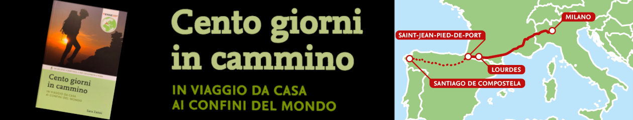
As a result , the options available to me today are limited but it was still necessary to make choices. In the first place , to get to France, I chose to go to the west the Via Francigena , reaching Pavia and then following the reverse path, up the Val di Susa to Montgenevre . From there I will follow the Via Domitia, whose path has been restored in recent years and is now available both in the direction of Santiago de Compostela and to Rome. The Via Domitia will lead me to Arles , where we will need to make another choice. Having decided to follow the Way of the Pyrenean Piedmont, instead of the Via Tolosana , for reasons of distance and time, we will need to reach Carcassonnne, the most convenient place from which to begin the Way. The options are different: go to Aigues Mortes and then reach the coast towards Palavas -les- Flots, or, as it probably will be, along with who I want to get into this, cut south to Saintes Maries de la Mer, across the ponds of the Bouches- du-Rhône and then get to Palavas -les- Flots and from there to Béziers, and from there, we’ll reach Carcassonne.
From Carcassonne the route continues along the Pyrenees, crossing places which abound in caves decorated with prehistoric rock paintings and engravings, the centers involved in the medieval Cathar heresy, touching Lourdes and finally reaching what in the Middle Ages was known as the Pas de Cize: the Puerto de Ibañeta, leading to Roncesvalles and the beginning of the French Way to Santiago and then to Fisterra.
Other choices could be done, other routes could be followed, but now the route is marked: to each his own Way! Buen Camino!